What Is a High-Altitude Platform Station (HAPS)?
A high-altitude platform station, HAPS, is an aircraft or airship that operates in the stratosphere for long periods, doing some of the jobs we normally.

A high-altitude platform station, HAPS, is an aircraft or airship that operates in the stratosphere for long periods, doing some of the jobs we normally rely on satellites for, but from far closer to the ground. They’re sometimes called “atmospheric satellites” or pseudo-satellites and they sit in a sweet spot between aeroplanes and spacecraft.
Where they fly and why there
Most HAPS are designed to operate around 18–20 km up, roughly 60,000+ feet, well above commercial air traffic (which cruises around 10–12 km) and above the weather, clouds and strongest winds. The stratosphere is relatively calm and, crucially, sunlit, which matters because most HAPS are solar-powered. Staying in that band lets an aircraft hold position over a region for a long time without the turbulence and cloud cover of lower altitudes.
How they work
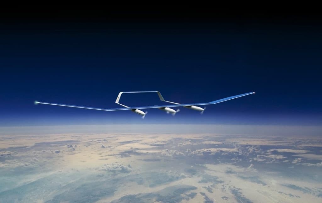
A typical HAPS is a solar-powered, uncrewed aircraft with a very large wingspan and a very light structure, the wings are covered in solar panels that power the motors by day and charge batteries to fly through the night. Because it carries no fuel, its endurance isn’t limited by tanks but by how well it manages energy and survives the conditions. The aim for the most ambitious designs is essentially perpetual flight: staying aloft for weeks or months at a time. (Some HAPS concepts use airships or balloons instead of fixed-wing aircraft, but the solar-aircraft approach is the most active.)
What they’re for
A HAPS can do many things a satellite does, Earth observation, imaging, communications relay and some things satellites can’t. Because it flies far lower than a satellite, it can capture much higher-resolution imagery; because it can be steered and stay put, it can watch one area continuously; and because it lands, its payload can be upgraded or repaired. Typical uses include environmental and climate monitoring, maritime and border surveillance, precision agriculture, disaster response and providing connectivity to remote areas. Different operators specialise: some target telecoms connectivity, while others, New Zealand’s Kea Aerospace among them, focus specifically on imaging and aerial data rather than communications.
HAPS vs satellites vs drones
The simplest way to place them: satellites offer global reach but are costly, fixed in orbit and far away; drones and conventional aircraft are flexible and close but can’t stay up long; HAPS aim to combine the persistence of a satellite with the proximity and flexibility of an aircraft. The trade-off is that they’re hard to build, keeping a feather-light solar aircraft flying through stratospheric cold and jet-stream winds, day after day, is an unforgiving engineering problem and the field is still proving the endurance economics.
A New Zealand example
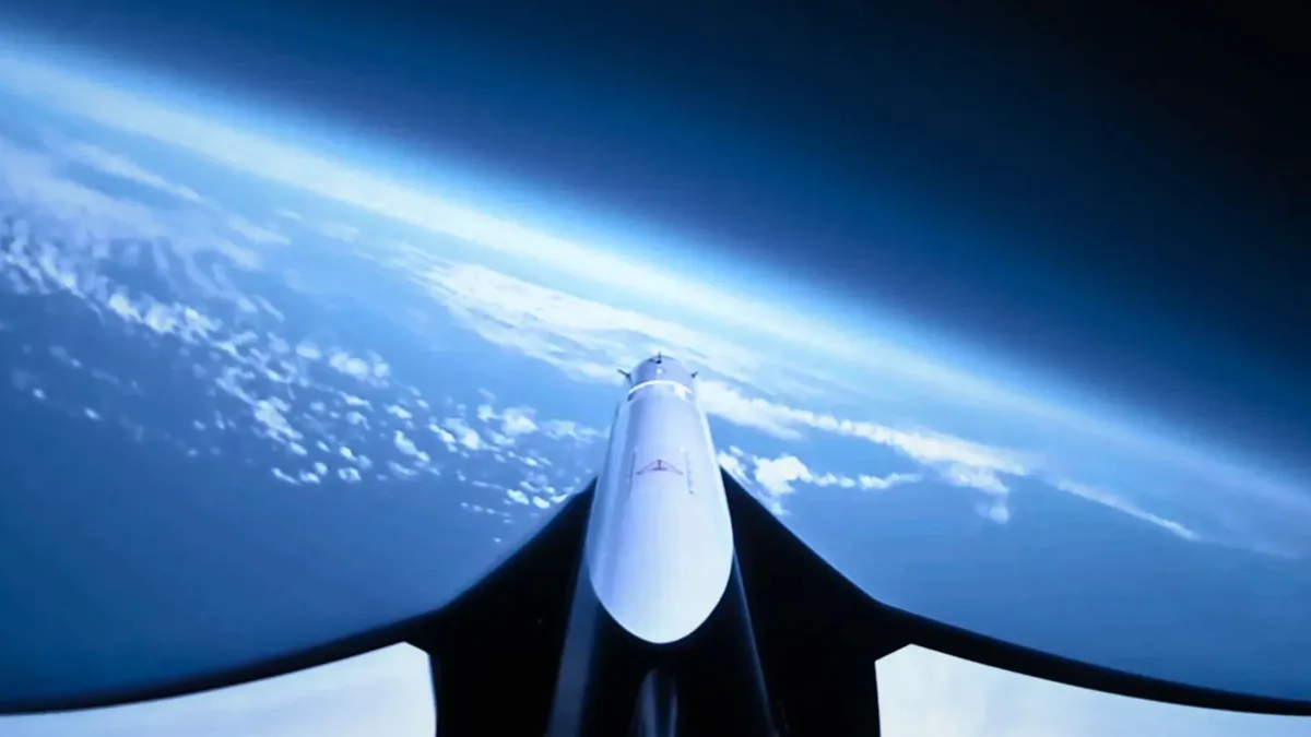
New Zealand’s main HAPS developer is Kea Aerospace, the Christchurch company whose solar-powered Kea Atmos reached the stratosphere in 2025 and is being developed toward multi-month flights. It’s a clear illustration of both the promise of high-altitude platforms, persistent, high-resolution, lower-cost aerial data and the long engineering road to getting there.